Island group
Cyclades (the easternmost island of the group), South Aegean, Greece; in the eastern Aegean between Naxos and the Dodecanese
Size and population
about 126 km2 (126.35); roughly 1,960 residents (1,961 at the 2021 census); highest point about 823 m
Airport
none; Amorgos is reached only by ferry. Nearest airports are Naxos (domestic) and Santorini (international)
Ferry from Piraeus
about 4h 35m on the fastest boat to Katapola and up to about 9h 20m on a stopping conventional ferry; Aegiali from about 6h 20m. Seajets and Blue Star Ferries, three to seven days a week. Hops: Naxos about 1h 10m, Paros about 1h 45m, Santorini about 1h 10m, Koufonisia about 25m. The two ports are about 21 km apart
Hozoviotissa monastery
the Monastery of Panagia Hozoviotissa, eight storeys built into a sheer cliff about 300 m above the sea, still active. The Municipality of Amorgos gives 1017 for the building and 1088 for the renovation under Alexios I Komnenos; the icon is traditionally dated to 812 and Wikipedia says only “early in the second millennium”
Walking
seven numbered waymarked paths published by the Municipality of Amorgos, graded easy to hard. The Old Strata (path 1) runs Chora to Langada above Aegiali by way of the monastery, graded hard at four to five hours
The Big Blue
Luc Besson’s Le Grand Bleu, 1988, shot partly on Amorgos, most famously at Agia Anna bay
Best months
late May to June and September into early October; July and August are the hottest, busiest and windiest
Travel details last checked July 2026.
Where Amorgos is, and why so few people make it
Amorgos is the easternmost island of the Cyclades, set in the eastern Aegean between Naxos and the Dodecanese. It is small, about 126 square kilometres, long and narrow, and home to roughly 1,960 people. It rises to around 823 metres and has no airport, so you reach it only by ferry.
That remoteness is not a marketing line, it is geography. Amorgos is one of the steepest islands in the Cyclades, a mountainous spine dropping to a coast with few flat beaches, and it sits a long way east of Athens. Put the long crossing, the missing runway and the vertical terrain together and you have the reason the cruise ships and the package crowds largely skip it. The island of Amorgos is small, steep and hard to reach, and it is quieter for exactly those reasons.

Diagram by Greece Trips. Free to reuse with credit - CC BY 4.0.
Three places anchor the map, and they sit far apart. Katapola is the main port, roughly central on the south coast. Chora, the capital, stands inland on a hilltop above it. Aegiali is the second port and its bay, up at the northern end. The municipality puts Aegiali about 21 km from Katapola port by road, which on a long, narrow mountain island is a real journey, and it is why the ferry you catch and the car you rent both come back to where those three points are. You can place Amorgos among its neighbours on the Cyclades page, or see where it sits on the map.
The Hozoviotissa monastery, and how to actually visit it
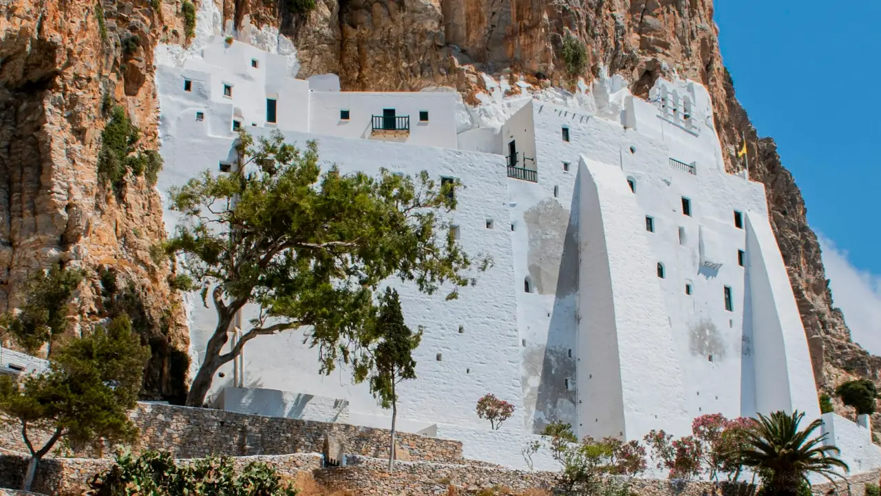
The Monastery of Panagia Hozoviotissa is the reason most people put Amorgos on a list at all. It is a narrow white building of eight floors, carved into a sheer cliff face roughly 300 metres above the sea on the island’s south-east coast, below Chora and above the small beach at Agia Anna. It is one of the oldest and most dramatic monasteries in Greece, and it is still a working one, home to a handful of monks.
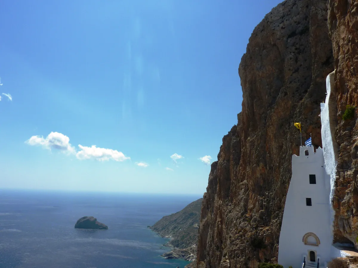
Its age is genuinely unsettled, and the honest thing is to say so. The Municipality of Amorgos, on its own pages, gives two dates rather than one: built in 1017 and renovated in 1088 under the Byzantine emperor Alexios I Komnenos. It houses an icon traditionally dated to 812, and Wikipedia settles for the cautious “built early in the second millennium”. Founded early in the second millennium, with the municipality’s 1017 and 1088, is as precise as the sources honestly allow.

Diagram by Greece Trips. Free to reuse with credit - CC BY 4.0.
A visit is a real climb and a real set of rules. Here is what to expect:
- The climb. You leave the road and walk up a stepped path to the entrance set into the rock, then up through the floors inside. It is short but steep.
- The dress code. This is an active monastery and it publishes its expectation plainly: visitors are asked to be decently dressed, men in long trousers, women in a long skirt, shoulders covered. It is enforced at the door. Travellers often report that wraps and cover-ups are available at the entrance, but arriving already covered is the only version of this that cannot go wrong.
- The timing. It is a monastery, so its day runs in two halves: a morning window, a long closure through the middle of the day, and a shorter reopening in the late afternoon. Go in the morning, and check the current schedule locally before you climb rather than trusting a time you found in advance, because hours move with the season and the calendar.
- The welcome. By tradition, the monks offer visitors who make the climb a small treat: psimeni raki, the local spirit sweetened with honey and spices, and a piece of loukoumi. Take it as the custom it is, not a guarantee.
For how to behave inside a Greek church or monastery more generally, see Greek etiquette and customs.
The Big Blue, and why divers keep coming
Much of Luc Besson’s 1988 film The Big Blue (Le Grand Bleu) was shot on Amorgos, most memorably at Agia Anna bay, directly below the Hozoviotissa monastery. The film is a fictionalised telling of the rivalry between the free-divers Jacques Mayol and Enzo Maiorca, and it did something few films do for a place: it turned a quiet, hard-to-reach island into an international name and a pilgrimage for a certain kind of traveller.
That is not just trivia, because the film is the reason Amorgos has a diving identity at all. The clear, deep water that Besson filmed still draws divers and snorkellers, and there is a dive operation based up at Aegiali that runs guided dives and courses for a range of levels, with wreck and cavern sites offshore. You do not need to have seen the film to be glad of the water it made famous.
Keep The Big Blue in proportion, though. It is a strong reason to care about the sea here, and a good detour for fans who want to stand on the beach from the poster. It is not, on its own, a reason to plan a whole trip around, and you need not hunt for film-themed bars to feel you have paid your respects. The water does that. For what swimming in the Aegean is actually like, see what the Greek sea is like.
Katapola, Aegiali and Chora: the island’s three anchors
Amorgos is best understood as three places strung along a long island, and which one you base in is the practical decision the glossy guides skip. Katapola and Aegiali are the two ferry ports, at opposite ends; Chora, the capital, sits up in the hills between them. The first thing that decides your base is simple: which port your ferry actually uses.
Katapola, on the south coast, is the main and better-connected port, a working harbour spread around a broad bay. It is the most practical base for a first visit, closest to both the monastery and Chora, and the easiest place to arrive and get your bearings. It trades a little atmosphere for convenience.
Aegiali, at the northern end, is the smaller port, set on the island’s best sandy bay. It has a quieter, low-key feel, more a beach-and-hiking base than a transport hub, and it is where walkers and swimmers who want to slow down tend to settle. The trade-off is that it is further from the southern sights.
Chora, inland and uphill, is the whitewashed capital, and it holds the island’s evening character. Narrow marble-paved lanes climb to a Venetian castle, the Kastro, on its rock, with a row of windmills along the ridge and small churches tucked between the houses. It has no beach of its own, but it is where the island gathers after dark.
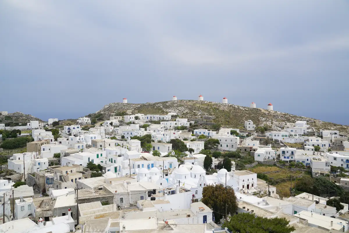
Nightlife, to be clear, is a handful of small bars in Chora and the two ports, a long dinner and a walk under the windmills. It is dinner-and-a-drink, not clubs, and that is the whole point of the place for the people who choose it. If Amorgos is one leg of a longer Cyclades plan, the island-hopping guide shows how the group links up.
Walking Amorgos: the old mule paths
Hiking in Amorgos is one of the best reasons to choose it over an easier island, and the trail network is older than the roads. Before the tarmac, the villages were linked by monopatia, stone mule paths worn into the hillsides, and many of them are now waymarked walking routes.
The walks worth knowing break down like this:
- The Old Strata, the “old path”, is the signature long route and the island’s path number one. It runs the spine from Chora past the Hozoviotissa monastery and on through Kapsala, Asfondilitis and Potamos to Langada, in the hills above Aegiali. The municipality grades it hard and puts it at four to five hours.
- Village day-loops are the gentler option. The Valsamitis path makes a two-hour circuit out of Katapola and back by way of the ancient site at Minoa, and the Fotodotis path drops from Chora to Katapola in about an hour.
- The northern trails thread between the hill villages above Aegiali. The Melania path links Aegiali with Langada, Stroumbos, Panagia and Tholaria in a couple of easy hours, and makes a half-day from that end of the island.
The Municipality of Amorgos publishes seven numbered waymarked paths, each with a grade and a rough walking time. Treat those times as the municipality’s own estimate rather than a promise, because they depend on the day and the walker.
What you get underfoot is old stone paving and dry-stone terraces, whitewashed chapels, and long views over sea and mountain, in a mix of gentle village strolls and one serious multi-hour traverse. It suits the day-walker and the committed hiker equally.
Time it for spring or autumn. High summer is hot, the exposed sections catch the meltemi wind off the sea, and the light is harsh by midday. The shoulder months are when the trails are at their best, the same shoulder-season logic that rewards walkers across the islands. Guided and self-guided are both easy to arrange; the paths are marked well enough to walk on your own if you are sure of your footing.
Beaches: dramatic, mostly rocky, worth the effort
Amorgos is not a golden-sand island, and it is better to know that before you arrive than to feel let down on day one. Most of its beaches are pebble, rock or small sheltered coves, several of them reached by steps, a boat or a rough track, and the exposed ones catch the summer meltemi. Read that as a feature rather than a flaw: it is why the water is clear and the crowds are thin.
A handful are worth knowing by name, and they do not close or rebrand the way a beach bar does. Agia Anna is the small, rocky one below the monastery, the Big Blue beach, more a place to swim off the rocks than to spread a towel. Mouros, on the south coast, is a pebble cove with sea caves to explore. Maltezi is a sheltered cove a short walk or boat-ride from Katapola. The sandy bay at Aegiali is the most family-friendly and the most organised. Kalotaritissa, in the far south, is sandy and sheltered, and the little offshore islet of Nikouria, with Agios Pavlos opposite, is a boat-hop for clear water.
The practical part is access. A car or scooter, or a summer beach boat, puts most of the coast within reach; without one you are limited to what is near your base. And because the wind decides which coves work on any given day, the sensible move is to pick your beach by the day’s weather rather than fix on one in advance. What the Greek sea is like, meltemi included, is worth reading before you plan a beach day.
Getting to Amorgos: the long way in
Amorgos has no airport, so every route in ends on a ferry, and the real choices are which crossing and which port. The two realistic ways in:
- Direct ferry from Piraeus (Athens). The range is wider than most guides admit. The fastest boat to Katapola does it in about four and a half hours; a conventional ferry calling at other islands on the way takes up to nine. Aegiali, in the north, is always the longer leg. Seajets and Blue Star Ferries both run it, between three and seven days a week depending on the season. Book ahead in summer, when seats and cabins go early.
- Fly or sail to a nearer island, then hop across. Most people route via Naxos, which has a small domestic airport, or via Santorini or Paros. From Naxos it is a bit over an hour to Katapola and about two to Aegiali; from Paros under two hours, from Santorini about the same, and from Koufonisia less than half an hour on the Small Cyclades line.
That no-airport fact is worth stating plainly, because it shapes everything: the nearest airports are on Naxos, for domestic flights, and Santorini, for international ones, and you finish the journey by boat either way. Which islands do and do not have runways is laid out in which islands have an airport.
Frequency and speed are a seasonal trade-off, not a fixed timetable. Boats run far more often in summer than in winter; high-speed catamarans are faster and dearer than the conventional car ferries, and both the schedule and the crossing time move with the season and the operator. Treat any specific hour or fare as something to confirm on the day.
Then the detail that catches people out: ferries land at either Katapola, in the south, or Aegiali, in the north, and the two are far apart on a long island. Check which port your boat uses and base yourself accordingly, and do not assume every sailing calls at both.
One honest warning about a ferry-only island: the boat is the only way off, so a cancellation or a weather delay can leave you waiting. Build slack into the plan, and never connect a same-day international flight to a single afternoon ferry. What to do when a ferry is cancelled covers the options, and the mechanics of island ferries in general are in Greek island ferries. The two most useful gateways are Naxos, the nearest island with an airport, and Santorini.
When to go, and getting around once you land
| Gateway | Route type | Fastest sailing |
|---|---|---|
| Piraeus (Athens) | Direct ferry, fast boat or conventional | About 4h 35m to Katapola, up to about 9 hours on a stopping conventional ferry; Aegiali from about 6h 20m |
| Naxos | Ferry hop / Small Cyclades line | About 1h 10m to Katapola, about 2 hours to Aegiali |
| Paros | Ferry hop | About 1h 45m to Katapola |
| Santorini | Seasonal ferry hop | About 1h 10m to Katapola |
| Koufonisia | Small Cyclades line | About 25 minutes to Katapola |
Amorgos rewards two different visitors in two different seasons. Late May to June and September into early October are the sweet spot: warm enough to swim, the trails at their best, the meltemi milder and the island calm. July and August are the hottest, busiest and windiest stretch, with the ferries fullest, so book everything well ahead if those are your dates. Pick your window by what you came for, the walker wanting the shoulder months, the swimmer able to take the heat. The wider best time to visit Greece logic holds here too.
Once you land, a car changes the trip, though less than you might assume. The Amorgos Bus Company runs all year and says its routes reach the island’s villages, both ports, the main sights and the beaches daily, which covers more of Amorgos than the usual island bus. What moves is the timetable: the company itself tells arriving visitors to check for route changes once they are on the island, so treat the schedule as something you confirm rather than plan around. A car still buys you the freedom to chase a sheltered cove on a windy afternoon, which is the real argument for one here. A scooter is a real option for the confident, though the wind and the hairpin roads make it a genuine choice rather than a default. And because the island is long and mountainous, driving between the far ends takes longer than the map suggests. Whether an island like this needs a car of your own is worth thinking through in which islands need a car, and the practicalities are in renting a car in Greece.
Who Amorgos is for, and who should skip it
Amorgos is worth visiting if you want a steep, dramatic, uncrowded Cyclades island with a cliff-hung monastery, real hiking and clear diving water, and you do not mind earning it with a long ferry. It is not the island for you if you came for golden-sand resorts, easy access or a night out, which Amorgos is not and does not pretend to be.
It fits walkers and divers, couples and quiet-seekers, film fans standing on the Big Blue beach, and island-hoppers building a far-eastern leg into a Cyclades route. It is the wrong island for a fly-in beach week or a party, and that is not a fault, just a different trip, with easier islands ready for it. If Amorgos sounds like your kind of quiet, see whether it fits a couples trip or slot it into a Cyclades island-hopping route with the calm one at the far end.
Amorgos FAQ
Where is Amorgos?
Amorgos is the easternmost island of the Cyclades, in the eastern Aegean between Naxos and the Dodecanese. It is small, about 126 square kilometres and mountainous, with roughly 1,960 residents, and it has no airport, so you reach the island of Amorgos only by ferry. You can see where it sits on the map.
Does Amorgos have an airport, and how do you get there?
Amorgos has no airport. You reach it by ferry, either the direct crossing from Piraeus (Athens), which runs from about four and a half hours on the fast boat to nine on a conventional ferry that calls at other islands, or by flying or sailing to Naxos or Santorini and hopping across in a bit over an hour. Ferries land at either Katapola or Aegiali, about 21 km apart at opposite ends of the island, so check which port your boat uses.
Was The Big Blue filmed on Amorgos?
Yes. Much of Luc Besson’s 1988 film The Big Blue (Le Grand Bleu) was shot on Amorgos, most famously at Agia Anna bay, directly below the Hozoviotissa monastery. The film is why the island became internationally known, and why it still draws divers to its clear water today.
What should you wear to the Hozoviotissa monastery?
It is an active monastery and it asks visitors to be decently dressed: men in long trousers, women in a long skirt, shoulders covered. Travellers report that cover-ups are available at the door, though arriving already covered is the only version that cannot go wrong. Go in the morning, expect a climb up a stepped path, and check the current hours locally, because the monastery closes through the middle of the day and reopens in the late afternoon.
How many days do you need on Amorgos?
Give Amorgos at least three or four nights. The ferry in is long, the island is spread out between two far-apart ports, and rushing the monastery, a couple of beaches and one good walk defeats the point of coming this far. A week suits walkers and divers, who will find plenty to fill it.
Why do people search for Amorgos as the 25th island of Greece?
That one is an internet joke, not a travel fact. “Amorgos” sounds like the game “Among Us”, so people were dared online to “search the 25th island of Greece”, and Amorgos happens to rank about 25th by size. The real Amorgos has nothing to do with the game: it is the easternmost Cyclades island, with the cliff-hung monastery and the clear water that made The Big Blue.
Plan by category
The Amorgos guides
5 guides, each scoped to a decision you actually have to make.
 Attractions
Things to do
See the attractions →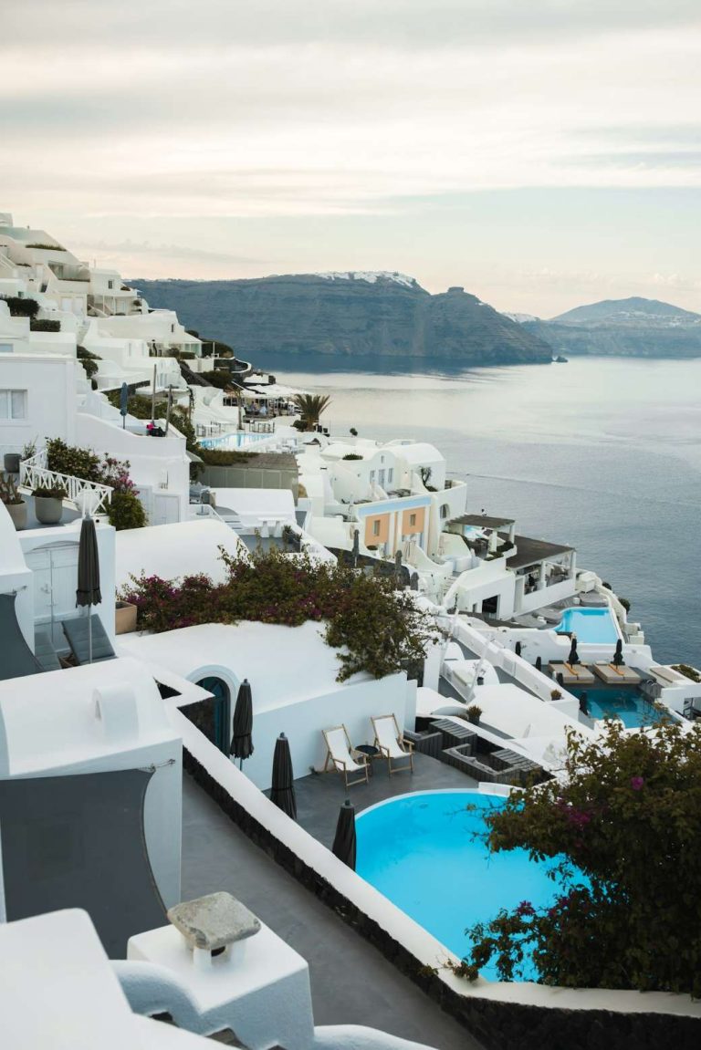 Hotels
Where to stay
Compare the areas →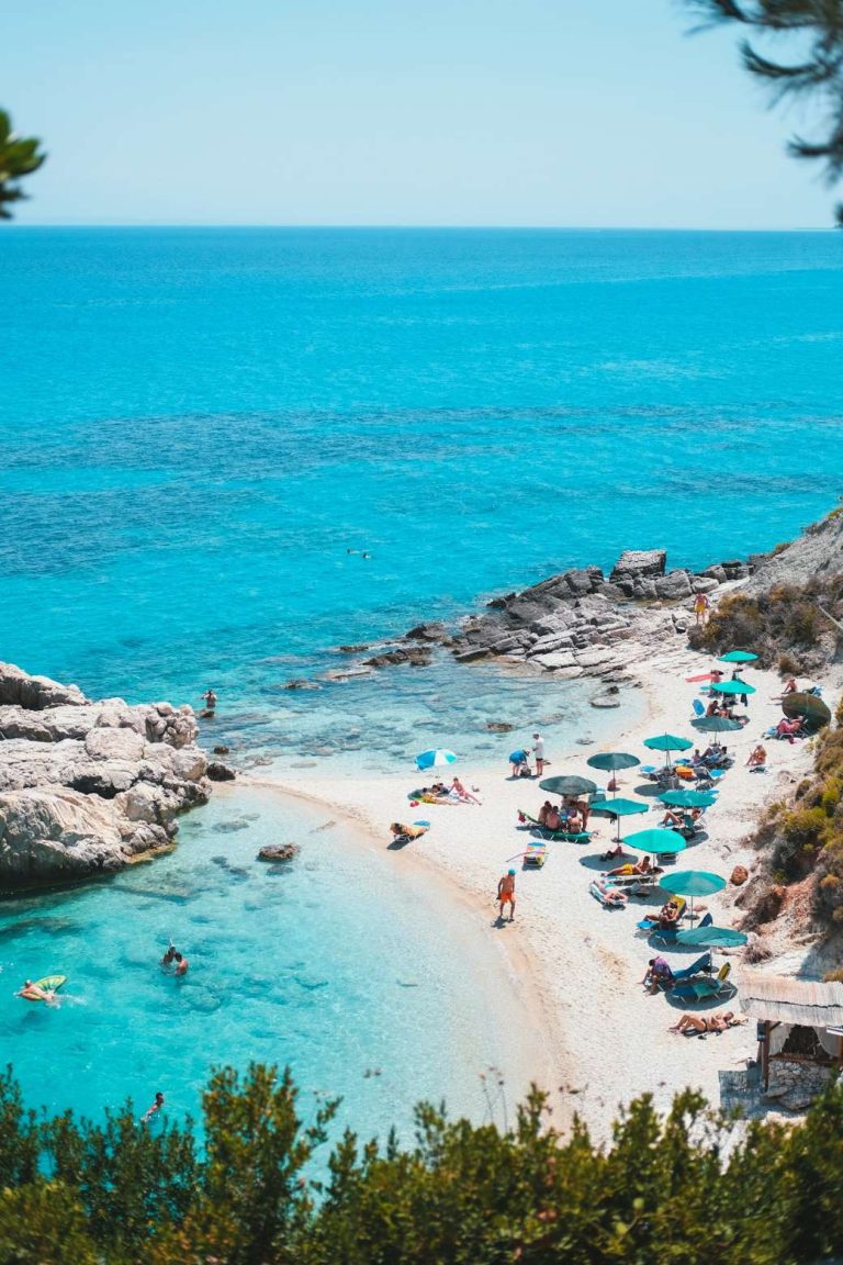 Beaches
The beaches
See the beaches →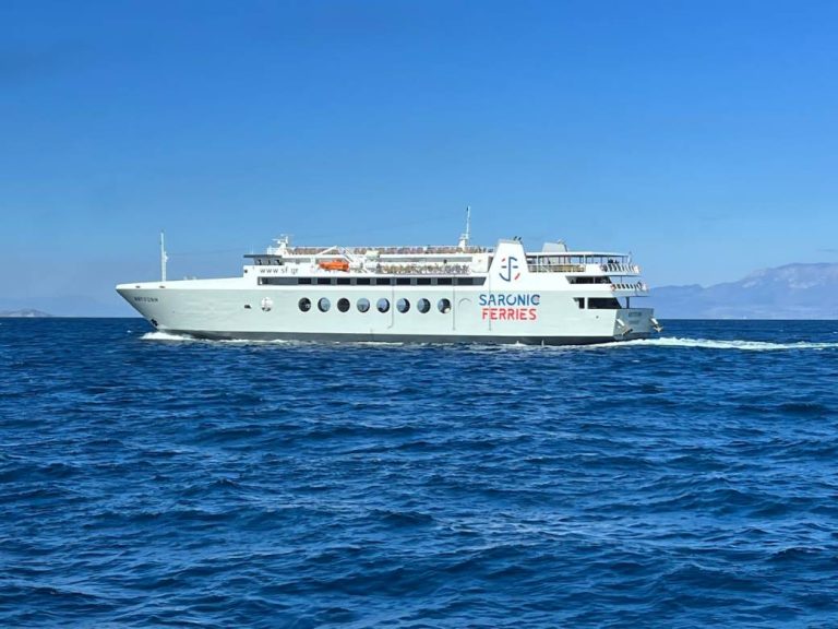 Itinerary
Day by day
See the itinerary →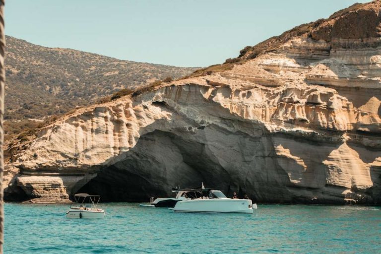 Day trips
Day trips
See the day trips →
Booking
We sell nothing and book nothing for you. Every guide on this page tells you how to arrange each piece yourself - which ferry operator, when to book, what to prebook and what to leave loose.