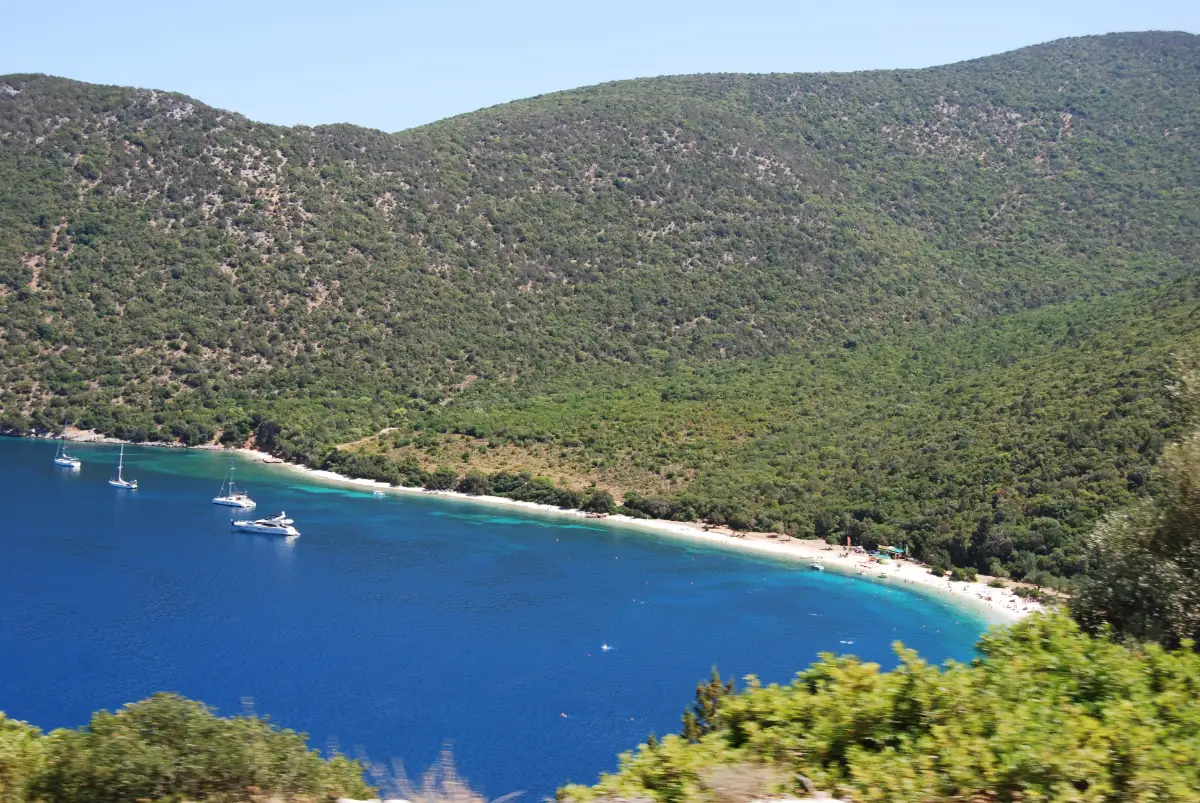
It is pebbles and not sand, and the stones hold the afternoon heat: something for your feet is the advice people repeat after they have been.
Two things then decide the afternoon. The bank keeps shelving once it is under water, so the sea is over your head within a few strides. And the green land on the horizon is not more of Kefalonia. It is Ithaca, across the strait.
The island guide calls this the east’s best swim.

Diagram by Greece Trips. Free to reuse with credit - CC BY 4.0.
The bank: white stones, and water over your head early
The stones are small, rounded and pale, and they hold heat. Beach shoes are the most repeated piece of practical advice from people who have been.
What those stones do under water matters more. One Greek destination guide reports no long shallow area and a seabed that drops off quickly, and reviewers describe the water going over their heads a few metres out. The bank carries on below the surface at much the angle it keeps on land, so the milky turquoise band along the shore is narrow and the colour changes quickly as you walk in.
What this page will not do is tell you whether that suits you. The sea moves, and that judgement belongs to the person standing in it, to the flag and to any lifeguard on duty. It is not a certificate a web page is in a position to issue.
The same drop has a good side. Clear water over a stone bottom that falls away is a snorkelling bay, and snorkelling is one of the most consistent things visitors report here. Bring a mask, and see what the sea is like.
Why the water reads green here and blue at Myrtos
The colour is not a filter. Steep wooded ground wraps this bay on three sides and comes down almost to the back of the bank, and the water reflects it. That is why Antisamos reads green where an open, pale-cliffed bay on the same island reads blue. Over pale stone in clear water the shallows go milky turquoise, and the green arrives with the depth.
The same wooded bowl catches people out when they pack. The trees stop where the stones start, so the bank sits at the foot of the woods rather than under them. Shade on the beach is rented or carried in.
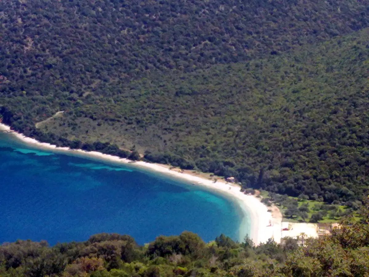
Myrtos, on the west coast, sits under pale bare cliffs and photographs blue.
The road over the headland, and where you park
On this island the headline beaches are usually things you look down at, and Myrtos is a viewpoint first and a swim second. Antisamos is the other kind. A paved road climbs out of Sami, crosses the headland east of the port and drops to the bay, ending behind the pebbles, so you walk from the car onto the stones.
The descent bends, and reviewers describe hairpins on the way down. Our island guide puts Sami to Antisamos at about ten minutes, marked there as third-party rather than measured, and no new figure goes on this page. People walk the road too, and it climbs.
The bus we cannot settle. KTEL Kefalonia’s own page for the beach says its buses take you next to it; the summer route list on the same site, read in July 2026, names the villages around Sami without naming the bay. If you are not driving, take a taxi from Sami and ask at the bus station for your dates.
Renting a car is the practical side of this island.
What the film built here, and what it built at Sami
Captain Corelli’s Mandolin was made on Kefalonia in the summer of 2000 and released the following year, and this bay is where the Italian army arrives and pitches its tents.
The building happened at Sami, not here. According to movie-locations.com, the specialist location database, the seafront town you see on screen was built for the production at Sami’s port: the Venetian-style colonnade, the bell tower, the square and the town hall. A second, ruined village set stood at Old Vlachata. Sami was dressed to look as it did before the 1953 earthquake, and the same source records that the production’s elaborate on-site sets were dismantled immediately after shooting.
So what you recognise on the pebbles is the bay itself: the bank, the wooded slope, the strait in front. The landform is what was filmed, and the landform has not moved.
The caves above Sami and the rest of the island’s sights are on the attractions page.
Sami, Ithaca, and the hill above the bay
Sami is Kefalonia’s east-coast port, the one that faces the mainland’s western ports and the Ithaca side of the island, which is why a bay this far from the capital is easy to arrange. How the boats work is a guide of its own.
From the pebbles you look east at the southern end of Ithaca, across the Strait of Ithaca, which Wikipedia gives as roughly 4 to 6 km wide. First-time visitors take that green land for more of Kefalonia, and it is part of why the bay reads enclosed rather than open.
On the hill above the port stands the Monastery of Panagia Agrilion, looking down onto the bay and across the strait.
Who it suits, and when the bay fills
Come here if you are based at Sami, if the morning went to the caves, if you swim or snorkel, or if you want a headline Kefalonia bay you can drive onto.
Choose differently if you want sand underfoot, a shallow wade or natural shade. The island’s easy sand is in the south, which the beaches guide sorts out, and Petani is the quieter west-coast pebble.
It fills in July and August. The sunbed rows go up early over part of the bay and the rest stays open pebble, so space is a matter of walking away from the bars. The shoulder either side of high summer is the better trade, which is what when to come is for.
What needs booking on this side of the island is the room and the car, not the beach: where to stay on Kefalonia covers the first.
Antisamos FAQ
Is Antisamos beach sandy or pebble?
Pebble, not sand. Small rounded pale stones run the length of the bay and continue under the water, and they hold heat. One widely read guide calls the surface soft sand; four others and a review corpus of several thousand entries say white pebbles.
How deep does the water get at Antisamos beach?
We could not find a published depth. One destination guide reports no long shallow area and a seabed that drops off quickly, and reviewers describe deep water a few metres out. What that means for your swim is yours to judge. The same drop is why people bring a mask.
How do you get to Antisamos beach from Sami?
You drive or take a taxi over the headland east of the port, to the parking behind the pebbles, about ten minutes on our island guide’s figure. Bus reports conflict, including within the operator’s own site, so check locally for your dates.
Was Captain Corelli’s Mandolin filmed at Antisamos beach?
Yes, in the summer of 2000: this is where the Italian soldiers arrive and pitch their tents. The seafront town on screen was built for the production at Sami’s port, a ruined village set stood at Old Vlachata, and those on-site sets came down immediately after shooting. What you recognise here is the shape of the bay.
Is there shade at Antisamos beach?
The bay is wrapped in wooded hills and the beach still sits in full sun, because the bank is at the foot of the trees rather than under them. Shade is rented or carried in.
What is the land you can see across the water from Antisamos?
Ithaca: its green southern end, across the Strait of Ithaca, roughly 4 to 6 km wide by Wikipedia’s figure. An island in the view is why the bay reads enclosed rather than open.
Is Antisamos or Myrtos the better beach?
Different objects. Myrtos is the one you look down at from the road above, on the west side; Antisamos is the one you drive onto, ten minutes from a port town. Want the photograph, Myrtos. Want an afternoon in the water, here.
Bring something for your feet
A pebble bank that shelves away early, green water under wooded hills, and Ithaca on the horizon. It is the Kefalonia headline beach you drive onto rather than look down at.
Last checked July 2026. What gets re-checked here is the organised part of the bay and the bus reports; the bank, the hills and the strait are geology. How we check and date facts is in our editorial policy.