Where
The Gramvousa peninsula at the northwest tip of Crete, between Cape Gramvousa and Cape Tigani. About 56 km northwest of Chania, about 17 km northwest of Kissamos
Getting there by sea
Excursion boat from Kissamos, usually calling at Imeri Gramvousa and its Venetian fortress
Getting there by land
About 10 km of unsurfaced track from Kaliviani, a charge near Kaliviani for the reserve and the road, parking above the lagoon, then about 1 km of path down. Many hire-car agreements exclude that road
The beach
White sand, shallow water. Muddy seabed in the shallows, which sometimes produces a smell in warm shallow water
The Region’s record
Lifeguard: no. Natural shade: no. Umbrellas and sunbeds: yes. No restaurants or accommodation nearby. Not listed as accessible for people with special needs
Protection
In the Natura 2000 network. Eleonora’s falcons, shags and cormorants recorded nesting in the caves; monk seal and loggerhead turtle recorded on these shores. Site codes deliberately not printed
Best hours
Early or late. Both the boat crowd and the track crowd land in the middle of the day
Travel details last checked July 2026.
It is also about 56 kilometres northwest of Chania and about 17 northwest of Kissamos, at the end of either a boat crossing or an unsurfaced track, and the getting there is the entire subject of a Balos day.
So this page is mostly about arriving, and then about two things the Region of Crete’s own record says that nobody quotes.
The two ways in
They are not variations on one trip. They are different days.
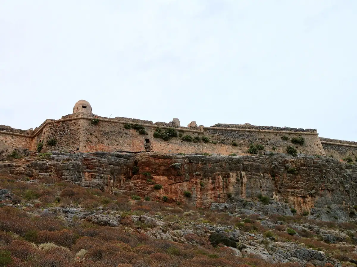
The boat from Kissamos. Kissamos, also called Kastelli, is the port out in the far northwest of the Chania region, and the excursion boats to Balos sail from there. The crossing usually calls first at Imeri Gramvousa, the islet with the Venetian fortress on top of it, and then continues to the lagoon. Our Chania guide already places Kissamos as the second port of the region and the departure point for exactly this. We name no boat and print no fare or timetable, because those move every season and nobody publishes them durably.
The track from Kaliviani. The alternative is a dirt road that runs about 10 kilometres from Kaliviani out along Cape Gramvousa, ending at a wide parking area next to a canteen on the height above the lagoon. There is a charge levied near Kaliviani which goes towards the protection of the Gramvousa reserve and the upkeep of the road; we print no figure for it, because none was read at an authority.
Then the part people miss entirely. The track does not deliver you to the beach. From that parking area a path about a kilometre long goes down to the lagoon, and the reference that describes it calls the return quite strenuous and tiring because of the incline. You come back up it at the end of a hot day, carrying whatever you carried down.
We are not going to rate that walk or that road for you, in either direction. What we can hand you is the fact that decides it for most people, and it is contractual rather than geological. Our Crete guide says it flatly: the road to Balos is notorious, and many hire cars are not insured for it. That is a clause in your rental agreement, not an opinion about a surface, and it is worth reading before you turn off the tarmac. Renting a car in Greece covers what those agreements usually say, and driving in Greece covers the roads generally.
The practical upshot, which our Chania guide already reaches: most people take the boat.
What the Region’s own record says
Crete’s regional tourism body publishes a structured record for its beaches, and Balos has one. Two of its fields matter more than anything on any travel page, including this one.
Lifeguard: no. Natural shade: no.
That is the authority’s own inventory, not our inference, and it changes how you plan the day. There is nothing growing out there to sit under, the lagoon sits in an open bowl of dry rock, and the Region records no lifeguard service. The same record lists umbrellas and sunbeds as present, which is a seasonal concession rather than shade you can rely on, and lists no restaurants and no accommodation nearby. It also records the beach as not accessible for people with special needs, which given the kilometre of path and the incline is the honest entry.
We are stating those as facts about the beach’s provision and nothing more. A missing lifeguard is not a statement about the water, and a present one would not have been either. The sea moves, no page can see your day, and rating it is not something we are in a position to do.
Carry water. More of it than you think, because the walk back up is at the end.
The thing nobody prints about the lagoon
Here is the expectation-management fact, and it is on a Crete reference site rather than in any of the photographs.
The lagoon is shallow and warm, which is what makes the colour. The seabed in those shallows is muddy in places rather than clean sand, and the combination of warmth and shallow standing water lets microorganisms grow, which sometimes produces an unpleasant smell.
Sometimes. Not always, and not everywhere in the lagoon. But it is real, it is why some visitors come back baffled by the gap between the photograph and the afternoon, and knowing it in advance is worth more than another paragraph about the turquoise.
The wider lagoon is deeper and clearer as you move away from the shallowest water, which is where most people end up swimming anyway.
A protected place, and what that asks of you
The lagoon and the peninsula around it are in the Natura 2000 network. The reference that describes the area records Eleonora’s falcons, shags and cormorants nesting in its caves, and lists the Mediterranean monk seal and the loggerhead turtle among the species that use these shores.
We are attributing that rather than presenting it as a survey we conducted, and we are deliberately not printing the site codes, because we did not open the official data forms behind them.
What it asks of you is not complicated. Stay on the path rather than cutting the slope, which is what keeps the dry vegetation and the erosion under control on a headland with very little soil. Take everything out with you, because nothing is collected down there. And treat the birds and the sea life as things you are visiting rather than things that are on show.
Fitting it into a Crete trip
Balos is a west-Crete day, and it is a day rather than an afternoon.
Chania is the base that makes it work, along with Falassarna, Elafonisi and the Samaria Gorge, which is the set our Chania guide is built around. From Heraklion or the eastern resorts this is not a sensible day trip in any honest sense, and our Crete guide makes the general version of that point: you can see Crete’s cities without a car, but not Crete.
The excursion boat is booked directly with the operators, in Kissamos or through an agency, and it fills in July and August. What you book for a Balos day is the boat seat or the car, and what a Greece trip costs has the wider bands.
Go early whichever way you arrive. The boat crowd and the track crowd both land in the middle of the day and both leave in the late afternoon, so the beginning and the end of the day are quieter by a wide margin. And if the day you have chosen is windy, remember that this is an exposed northwestern headland, which is a very different proposition from a sheltered bay.
The short version
Balos is worth the effort and the effort is the point. Take the boat from Kissamos unless you have a vehicle and an agreement that permits the track, allow for a kilometre of path with a climb at the end of it, carry water and shade because the Region’s record says there is none, expect the shallows to be muddy in places, and go early. What you get for that is one of the most striking pieces of coast in Greece and a Venetian fortress on the way.
Last checked July 2026. What gets re-checked on this page: the Region of Crete’s own record for the beach, the Kaliviani charge, and the boat arrangements from Kissamos. No fare, charge figure, parking price, sunbed rate or operator name appears here by design. How we date and correct facts is in our editorial policy.
Common questions
How do you get to Balos beach in Crete?
Two ways. The excursion boat sails from Kissamos, also called Kastelli, in the far northwest of the Chania region, and usually calls at the islet of Imeri Gramvousa and its Venetian fortress on the way. Or you drive an unsurfaced track of about 10 kilometres from Kaliviani out along Cape Gramvousa to a parking area above the lagoon, paying a charge near Kaliviani that goes to the reserve and the road. The track ends above the beach: from the parking area a path of about a kilometre leads down. We name no operator and print no fare or timetable.
Can you drive all the way to Balos?
No. The track ends at a parking area on the height above the lagoon, and the last kilometre is a path down, with a climb back up at the end of the day that the Crete reference describing it calls quite strenuous and tiring because of the incline. There is also a contractual point that matters more than the surface: our Crete guide notes that many hire cars are not insured for that road, so read your rental agreement before you turn off the tarmac. Most visitors take the boat from Kissamos instead.
Is there a lifeguard or shade at Balos?
The Region of Crete’s own structured record for the beach answers both fields with a flat no: lifeguard, no; natural shade, no. It lists umbrellas and sunbeds as present, which is a seasonal concession rather than shade you can count on, and lists no restaurants and no accommodation nearby. Those are facts about the beach’s provision and nothing more: an absent lifeguard is not a statement about the water, any more than a present one would be. Carry more water than you expect to need, because the walk back up comes at the end.
Why does Balos sometimes smell?
Because it is a shallow warm lagoon. The Crete reference that describes it records a muddy seabed in the shallows and notes that the shallow warm water lets microorganisms grow, which sometimes produces an unpleasant smell. Sometimes, not always, and not across the whole lagoon: the water is deeper and clearer as you move out from the shallowest part, which is where most people swim anyway. It is the main gap between the photograph and the afternoon, and it is worth knowing before you spend a day getting there.
Is Balos protected, and what are the rules?
The lagoon and the surrounding peninsula are in the Natura 2000 network. The reference describing the area records Eleonora’s falcons, shags and cormorants nesting in its caves, and lists the Mediterranean monk seal and the loggerhead turtle among the species using these shores. In practice that means staying on the path rather than cutting across the slope, taking everything out with you because nothing is collected down there, and treating the wildlife as something you are visiting. The charge levied near Kaliviani on the road route is stated to go towards protecting the reserve.
Balos or Elafonisi, if you only have one day?
They are the two famous west-Crete lagoons and they are genuinely different days. Elafonisi is a long drive on sealed road through the mountains to a protected pink-tinged beach you can walk straight onto. Balos is a boat crossing or a dirt track plus a kilometre of path with a climb back. Balos gives you the more dramatic arrival and the fortress; Elafonisi gives you the easier day and the shallower water. Our Chania guide treats both as headline days out from the same base.
What time should you arrive at Balos?
Early, whichever way you come. The boat crowd and the track crowd both arrive around the middle of the day and both leave in the late afternoon, so the two ends of the day are noticeably quieter. Wind matters too: this is an exposed headland at the northwest corner of Crete, not a sheltered bay, and a blowy day is a different place from a still one.
Booking
We sell nothing and book nothing for you. Every guide on this page tells you how to arrange each piece yourself - which ferry operator, when to book, what to prebook and what to leave loose.