
Diagram by Greece Trips. Free to reuse with credit - CC BY 4.0.
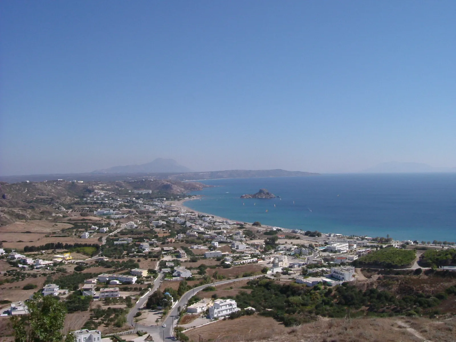
The bay is the island’s best stretch of sand, and it is confusing to plan because every section of it has its own name.
The beaches along the bay
From north-east to south-west, the same continuous sand is called by different names, each with its own access road, car park and set of facilities:
- Agios Stefanos, at the northern end, opposite the small islet with the ruins of early Christian basilicas on it. This is the postcard.
- Kamari, the built-up section with the village behind it, tavernas and rooms.
- Paradise, sometimes called Bubble Beach for the gas that rises through the sand offshore, the most organised part.
- Magic, Sunny, Banana and other names further along, each a car park and a stretch of sand.
Treat them as one beach with several doors, because that is what they are.
The islet and the basilicas
The islet of Agios Stefanos sits just offshore at the northern end, with the ruins of two early Christian basilicas and their mosaic floors on it. It is close enough to swim to in calm water, and the ruins are visible from the beach.
That combination, ancient ruins in the frame of a beach photograph, is the reason this end of the bay is the one people remember.
The village above
Kefalos village sits on the hill behind the bay, with a windmill, a castle ruin and views along the coast. It is a working village and quieter than the beaches, and it is where the buses terminate.
Practical notes
- The wind matters: this end of the island is exposed and the bay can be choppy.
- Each section has its own parking, so pick the name before you drive.
- Buses run from Kos Town in season and take a while; it is the far end of the island.
- Facilities are seasonal, thinning quickly outside summer.
Last checked August 2026. Access, names and facilities change seasonally - see our editorial policy.
Common questions
What is Kefalos on Kos?
The south-western end of the island: a long bay with a string of named beaches, a hill village above and the islet of Agios Stefanos offshore.
What is Paradise beach on Kos?
One section of Kefalos bay, sometimes called Bubble Beach because gas rises through the sand offshore, and the most organised part of the bay.
Can you swim to the islet at Agios Stefanos?
It sits close to shore and is reachable in calm conditions by confident swimmers. Conditions vary and there is no supervision.
How far is Kefalos from Kos Town?
It is at the far south-western end of the island, roughly forty-five minutes by car, with seasonal buses.
Which part of Kefalos bay should you choose?
Agios Stefanos for the islet and the view, Kamari for facilities and a village, and the further sections for space.
Next
Read best beaches in Kos, Tigaki, or where to stay in Kos.