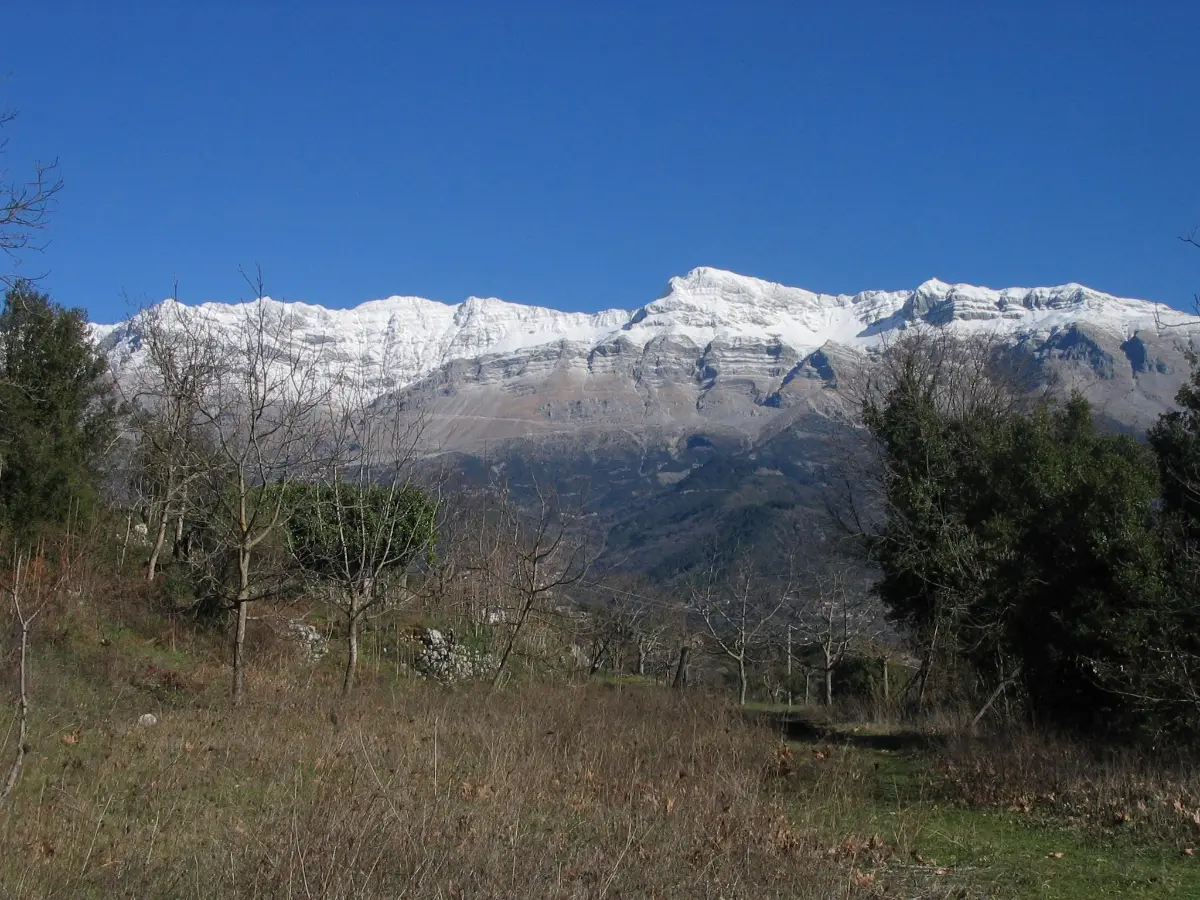
Tzoumerka is a range of steep limestone peaks in southern Epirus, rising over 2,300 metres, and it is one of the least-visited good landscapes in Greece.

Diagram by Greece Trips. Free to reuse with credit - CC BY 4.0.
Where Zagori to the north has become well known, Tzoumerka has not, despite being the same kind of country: stone villages, arched bridges, gorges and walking.
The villages
They are stuck onto the mountain flanks, often at the head of a ravine, built in grey stone with slate roofs:
- Syrrako and Kalarites, the two best known, facing each other across a deep gorge. Both are car-free in the centre, both were wealthy from stock rearing and silversmithing, and Kalarites was the birthplace of the founder of the Bulgari jewellery house.
- Pramanta, with the Anemotrypa cave beneath it, a river cave open to visitors.
- Melissourgoi, Agnanta and Theodoriana, the last with a waterfall behind it.
The bridges
Epirus built stone arched packhorse bridges and Tzoumerka has some of the finest: Plaka, over the Arachthos, was one of the largest single-arch bridges in the Balkans. It collapsed in a flood in 2015 and has since been rebuilt using the original technique and, where possible, the original stones, which is worth seeing in itself.
The river
The Arachthos runs through the range in a deep gorge and is one of the main rafting rivers in Greece, with commercial trips running in spring when the snowmelt is in. It is harder water than the Voidomatis in Zagori.
There are also waterfalls, of which the ones at Souda near Theodoriana are the most visited.
Getting there and how long
The range sits between Ioannina, about an hour, and Arta to the south. A car is essential and the roads are slow mountain roads.
Three nights, and it pairs naturally with Zagori for a longer Epirus trip.
Last checked August 2026. Mountain road and river conditions are seasonal - see our editorial policy.
Common questions
Where is Tzoumerka?
A limestone mountain range in southern Epirus, between Ioannina and Arta, rising above 2,300 metres.
How is Tzoumerka different from Zagori?
It is much the same kind of country, stone villages and gorges, but far less visited and with steeper, more dramatic peaks.
What is the Plaka bridge?
A large single-arch stone bridge over the Arachthos, once among the biggest in the Balkans. It collapsed in a flood in 2015 and has been rebuilt with the original technique.
Can you raft in Tzoumerka?
Yes, on the Arachthos, in spring when the snowmelt raises the river. It is harder water than the Voidomatis in Zagori.
What are Syrrako and Kalarites?
Two stone villages facing each other across a gorge, both car-free in the centre and both historically wealthy from stock rearing and silverwork.