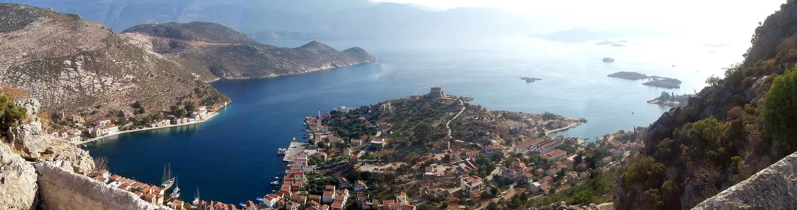
Kastellorizo is the easternmost point of Greece, a small island lying about two kilometres off the Turkish coast and roughly 120 kilometres east of Rhodes, which is the nearest Greek land of any size.

Diagram by Greece Trips. Free to reuse with credit - CC BY 4.0.
It is essentially one settlement: a horseshoe harbour ringed with tall painted houses in ochre, red and blue, with the hills bare behind them.
What happened to it
The scale of the harbour tells you the island was once far busier. Before the twentieth century Kastellorizo had a substantial merchant fleet and many thousands of people.
War, occupation, a catastrophic fire and evacuation emptied it, and most of the population left for Australia, where the Kastellorizian community is much larger than the island. Behind the harbour front, whole streets of roofless houses are still standing.
The permanent population now is in the hundreds. The diaspora returns in summer.
The Blue Grotto
The island’s natural sight is Parasta, a large sea cave on the south coast reached only by boat, with a very low entrance you lie down in the boat to pass through. Inside it opens into a big chamber where the light coming up through the water turns everything blue.
Boats go in the morning, when the light works, and cannot go at all in swell.
The rest
- The castle above the harbour, from which the island takes its Italian name, with a Lycian rock-cut tomb below it, carved into the cliff.
- The mosque, from the Ottoman period, now a small museum.
- Ro, the islet where Despina Achladioti raised the Greek flag daily for decades, a story every Greek knows.
- Swimming is off ladders and rocks; there is no beach.
Getting there and how long
A small airport with domestic flights via Rhodes, and ferries from Rhodes that take several hours and do not run daily. It is genuinely remote.
Three nights, largely dictated by the connections.
Last checked August 2026. Flights and ferries are sparse and weather-dependent - see our editorial policy.
Common questions
Where is Kastellorizo?
The easternmost island of Greece, about two kilometres off the Turkish coast and roughly 120 kilometres east of Rhodes.
Why is the harbour so big for the population?
The island had a substantial merchant fleet and thousands of residents before the twentieth century. War, fire and evacuation emptied it, and most people emigrated to Australia.
What is the Blue Grotto at Kastellorizo?
Parasta, a large sea cave on the south coast reached by boat through a very low entrance, where light through the water fills the chamber with blue.
Are there beaches on Kastellorizo?
No. Swimming is off ladders and rocks around the harbour and coast.
How do you get to Kastellorizo?
By domestic flight via Rhodes, or by ferry from Rhodes taking several hours and not running daily.